
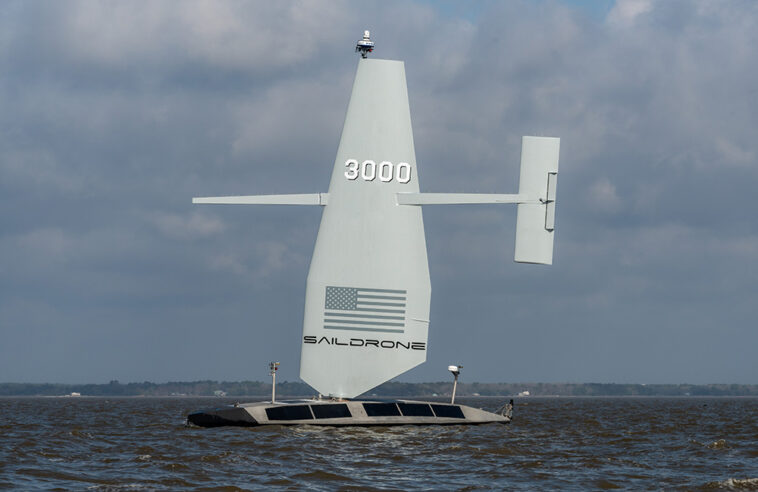
Equipped with a suite of advanced sensors, Surveyor delivers real-time intelligence, surveillance, and reconnaissance (ISR) above and below the surface. | Source: Saildrone
Saildrone Inc., in partnership with Meta, this week announced that it has completed a deep-water cable route survey in the North Atlantic using the Saildrone Surveyor, a 20-m (65.6 ft.) uncrewed surface vehicle, or USV. The company said the demonstration proves that autonomous platforms can deliver data quality and performance on par with traditional crewed survey vessels while reducing risk and cost.

“This mission demonstrated that autonomous ocean mapping is not just possible—it’s here, and it’s incredibly effective,” said Andy Palmer-Felgate, subsea cable engineer at Meta. “Saildrone delivered data that matched legacy surveys with exceptional accuracy, all while operating remotely and with minimal environmental impact.”
“As capacity needs increase, Meta continues to invest in cutting-edge infrastructure technologies — and our subsea cable strategy work is critical to these efforts,” he said. “Ocean mapping plays an important role, and the implications for subsea cable route surveys are profound.”
The companies completed the 26-day survey between June and July 2024. During the demonstration, the Saildrone Surveyor mapped more than 4,500 km (2,796 mi.) of seabed. This included complex topographies and challenging conditions, without a port call or outside assistance, said Saildrone.
Operating under sail and motor-sail modes and equipped with a Kongsberg EM304 MKII multibeam sonar, Surveyor achieved swath coverage of up to 10 km (6.2 mi.) in water depths of up to 5,500 m (3.4 mi.), the company said.
Alameda, Calif.-based Saildrone’s USVs use sophisticated sensors combined with proprietary AI algorithms. These provide a full picture of the maritime environment above and below the sea surface.
The Voyager USV earned Saildrone a 2025 RBR50 Robotics Innovation Award for mapping previously unexplored areas of the Gulf of Maine.
Surveyor exceeds expectations
The demonstration focused on collecting bathymetric data along the established Anjana cable route and the recently surveyed Aurora route. This allowed the teams to directly compare the Saildrone Surveyor’s performance against traditional crewed survey vessels. Key operational metrics—route fidelity, line keeping, data transmission, and depth accuracy—met or exceeded expectations across the board, Saildrone said.
Using the Saildrone Mission Portal and real-time, high-bandwidth satellite connectivity, Saildrone hydrographic surveyors and pilots monitored vehicle performance. The surveyors were able to dynamically re-task it to investigate features of interest, such as seamounts and canyons, critical for route optimization. Previously limited to crewed vessels, this capability opens the door to more agile, responsive, and distributed survey operations, Saildrone said.
A critical focus of the mission was minimizing health, safety, and environmental (HSE) risks associated with offshore operations. The team aimed to demonstrate significant benefits to the quality of life for hydrographic surveyors, cable route engineers, and client representatives.
With the Surveyor, these people can now perform their work remotely from shore-based offices or home offices, reducing time away from family and minimizing the physical and mental strain associated with offshore deployments, said Saildron. Furthermore, the mission avoided an estimated 243 tons of CO₂ emissions, over 50 times less than a conventional vessel, highlighting the sustainability advantages of uncrewed systems.
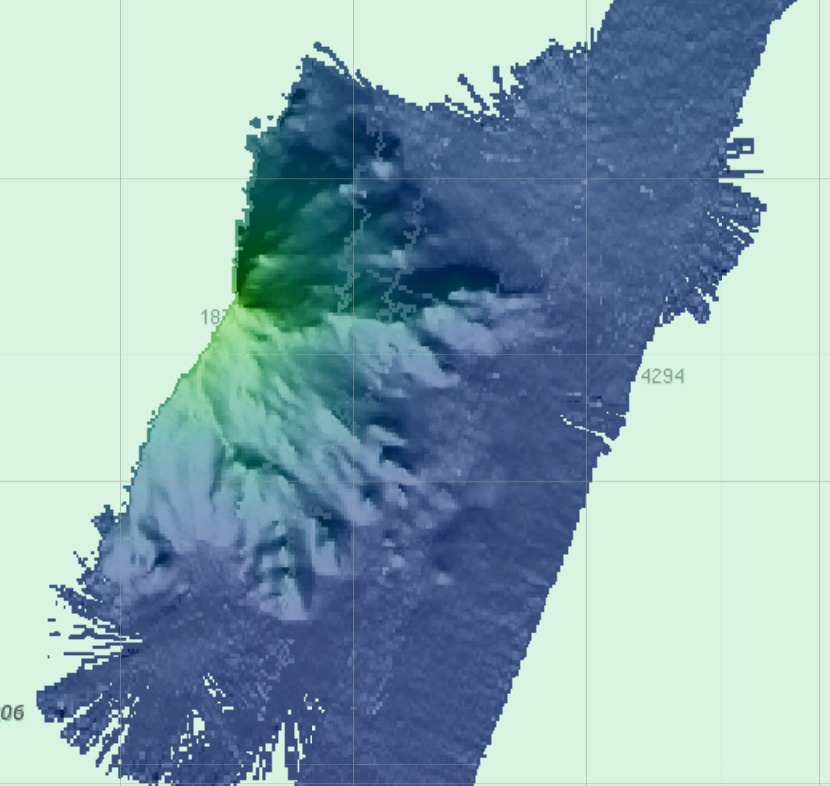
A map of the cable route on the seabed that Saildrone’s Surveyor produced. | Source: Saildrone
Saildrone looks to wider USV applications
This demonstration paves the way for broader adoption of USVs in subsea telecommunications, offshore energy, and national hydrographic programs, according to Saildrone. Future developments will focus on expanding operational range, improving weather resilience, and integrating new technologies like AI-based navigation and expendable bathythermographs.
“This is a turning point for deep-ocean survey,” said Brian Connon, vice president of ocean mapping at Saildrone. “The Surveyor’s performance on this mission proves that we can deliver high-resolution, deep-water bathymetry with a fraction of the fuel, cost, and risk. As our fleet expands, we envision a global network of Surveyor USVs supporting offshore industries with safe, efficient, and scalable data solutions.”
In May, Saildrone closed a $60 million investment round. The company said it will use the investment to bring its technology to Europe to address the urgent need for maritime security for critical infrastructure and wider defense applications.

Now accepting session submissions!


GIPHY App Key not set. Please check settings